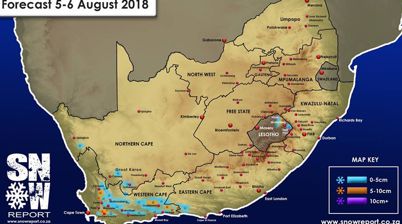
Snow for Western Cape
Monday 6th August : We are expecting a frontal system to make landfall in the Western Cape during Monday, and the first snow is expected to fall on the high peaks on Monday afternoon.
By Monday night, we expect snow to be falling across all the high peaks through the Cederberg, Hex River Mountains, Franschhoek , Boland, Langeberge, Swartberge and other high peaks. The freezing level could drop down to below 1000m in places, so some low level snow does seem possible.
We are however not expecting any heavy snow at this stage as there is limited moisture with this system. There is even a chance that Table Mountain could get some flurries on Monday afternoon and through the night on Monday into the early hours of Tuesday morning. It would be lovely to see it settle, but it seems unlikely as it will probably be accompanied by a bit of intermittent rain. There may also be some light snow in the Northern Cape through Monday night, but once again, there is limited moisture and as such, not much snow expected. Please refer to the forecast map for areas where snow seems possible at this stage. We will update again if we see any significant changes to this forecast.
Source: SnowReportSA – Facebook